IRENA lanceert een Global Wind Atlas

21 oktober 2015 – IRENA (International Renewable Energy Agency) lanceert vandaag een mondiale windkaart die heel gedetailleerd de gegevens combineert van 1.500 databestanden, tot op één kilometer nauwkeurig.
De kaart is ontwikkeld door de Technische Universiteit van Denemarken (DTU), waar al heel veel windgegevens verzameld worden.
Uit het persbericht van IRENA
‘(…) The most detailed data and statistics on global wind energy potential are now available online, thanks to a free resource launched today by IRENA and the Technical University of Denmark (DTU). The Global Wind Atlas provides wind resource data at one-kilometre resolution. Prior to this release, global wind data was only publically available at 10-kilometre resolution or poorer, which resulted in underestimations, increased risk and increased costs for wind energy planners.
“Wind energy potential across the globe is vast, but the upfront costs of measuring potential and determining the best locations for projects is an obstacle in many countries,” said IRENA Director-General Adnan Z. Amin. “The new Global Wind Atlas provides this needed data directly and for free, making it a ground-breaking tool to help jumpstart wind energy development worldwide.”
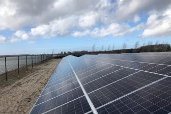
The Wind Atlas is the newest addition to the datasets available through IRENA’s Global Atlas, a renewable energy mapping tool. The dataset uses microscale modeling to capture wind speed variability on small scales, allowing for better estimates. When locating wind farms, developers naturally pick areas with the highest wind speeds. In datasets that provide average wind speeds over large areas, the enhancement of wind speeds due to small scale features such as hills and ridges are not captured, making the resource appear weaker than it actually is. The Wind Atlas can prevent this underestimation, provide visual maps showing wind speeds at three different heights, and also provide tools to generate and export data and statistics such as wind roses and wind speed distributions over a chosen area.
“The release of the Global Wind Atlas demonstrates the support of the international community to expand global renewable energy to address global climate change, increase electricity access and stimulate economic development,” said Danish Minister for Energy, Utilities and Climate, Lars Christian Lilleholt. “Denmark, together with South Africa, has already developed the South African Wind Atlas and we have seen the value of the tool in the development of the wind energy sector.”
The Wind Atlas builds on decades of expertise in wind mapping at the Technical University of Denmark. It was funded by Denmark as part of its commitment to the Clean Energy Ministerial (CEM) process, and represents the achievement of the goal set forth by the CEM’s Multilateral Solar and Wind Working Group to help increase the global share of renewable energy by providing the world with detailed and validated wind potentials through an online platform. (…)
The IRENA Global Atlas for Renewable Energy aims to close the gap between nations that have, and nations that do not have, access to the necessary datasets, expertise and financial support to evaluate their national renewable energy potentials. As of January 2015, 67 countries and more than 50 institutes and partners were contributing to the initiative. The geographic information system (GIS) and mobile app (Global Atlas Pocket) provide free access to over 1,500 datasets that contain solar, wind, geothermal, biomass, and marine energy potential for locations around the world. Online simulation tools allow to process this information and assess renewable energy potentials. (…)’
Het bedienen van de kaart vergt enige oefening.
Bronnen
IRENA, persbericht, 21 oktober 2015: IRENA and DTU Launch World’s Most Detailed Wind Resource Data
Toegang tot de Global Wind Atlas
Over DTU Energy